MANUAL OF MAP READING
AND FIELD SKETCHING (1906)
General Staff, War Office
HMSO, London, 1906
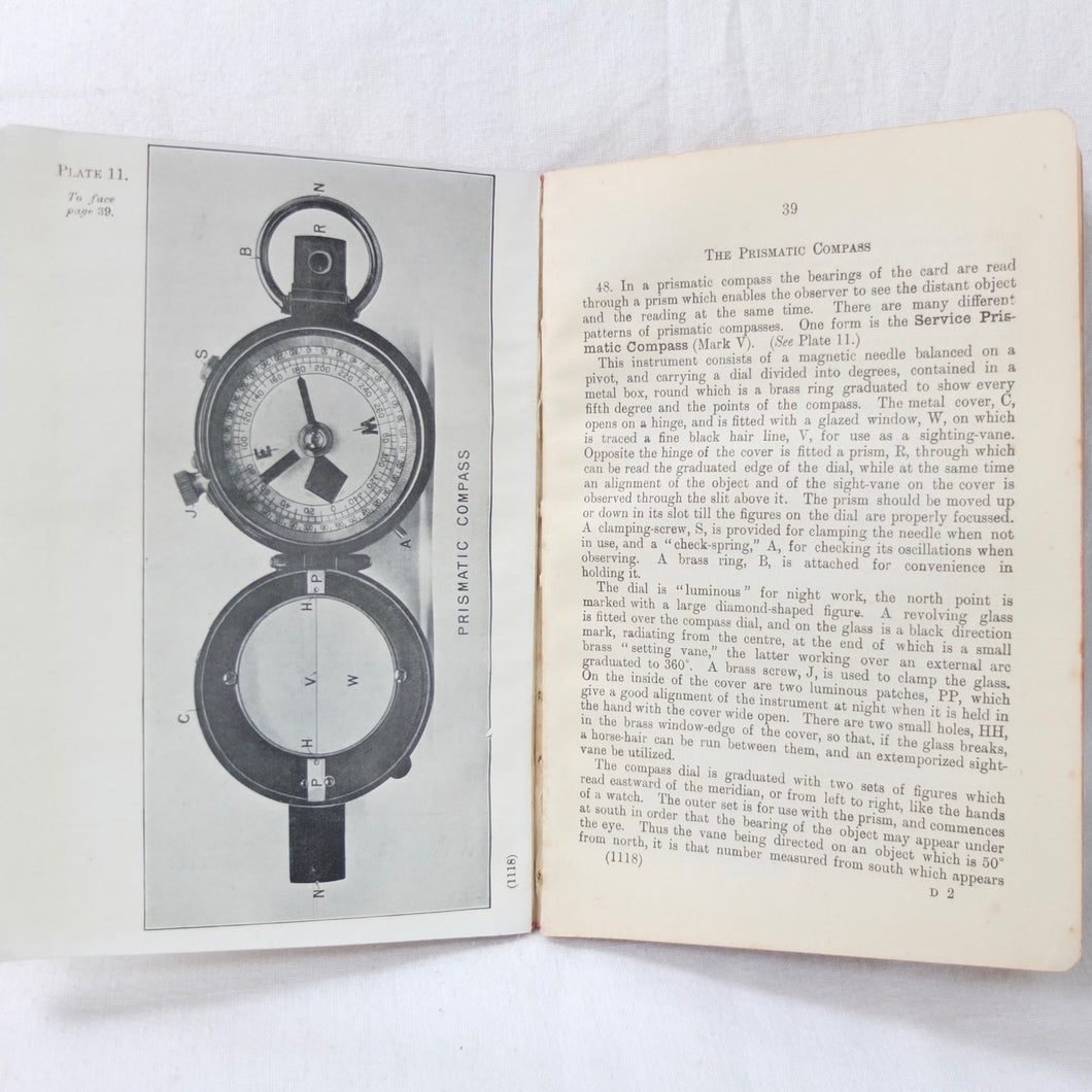
An original War Office manual covering military sketching, map reading and the use of the service compass. A comprehensive and detailed manual, written for Officers, N.C.O.s and soldiers and published in 1906. The book is well illustrated with line drawings, photographs, folding diagrams and maps (some in colour). Subjects covered include: military maps, scales, map reading, field sketching, instruments, plane table, prismatic compass, clinometers, cavalry sketching board, and landscape sketching.
The book is signed on the contents page by 'F. M. Livingston-James'. Captain Francis Montague Livingston-James was the adjutant of the 1/4th East Lancashire Regiment at the start of WW1. Commissioned as a 2nd Lieutenant in February 1905, he was made adjutant of the 1/4th E. Lancs in 1913 and went out to Egypt with them in 1914 to defend the Suez Canal. In May 1915 the 1/4th were sent to Gallipolli, before returning to Egypt in January 1916. In September 1916 Captain Livingston-James was seconded to the General Staff to serve as a Staff Officer.
Condition:
In good condition. The boards are in good condition. The binding and hinges are good and secure, the hinges having been carefully reinforced with archival paper tape. The text and illustrations are in very good condition, with a few minor marks.
Published: 1906
Maroon boards with gilt titling
Illustrated with drawings, diagrams, photographs & maps
Dimensions: 120mm x 175mm
Pages: 88 (plus folding plates)